NASA finds tropical storm Sarai strengthening

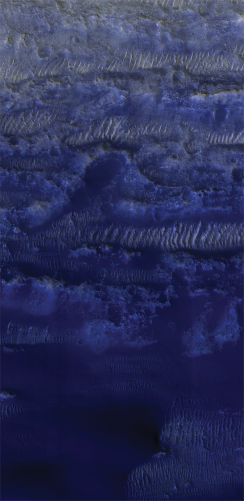
On Dec. 27 at 0135 UTC (Dec. 26 at 8:35 p.m. EST) NASA’s Aqua satellite analyzed the using the AIRS instrument. AIRS showed the strongest storms were located over the Lakshadweep Islands where the coldest cloud top temperatures as cold as or colder than 210 Kelvin (purple) minus 81 degrees Fahrenheit (minus 63.1 degrees Celsius) around the center (NASA)

NASA analyzed the cloud top temperatures in Tropical Storm Sarai using infrared light to determine the strength of the storm.  Already there are regional warnings in effect for Fiji and Tonga.

In Fiji, there is a storm warning is in force for Vatulele and Kadavu. A gale warning is in force for Vanua Levu, Taveuni, Yasawa and the Mamanuca Group, Kadavu, Lomaiviti Group, Viti Levu and nearby smaller islands. Tonga is on tropical cyclone alert

One of the ways NASA researches tropical cyclones is using infrared data that provides temperature information. Cloud top temperatures identify where the strongest storms are located. The stronger the storms, the higher they extend into the troposphere, and they have the colder cloud temperatures.

On Dec. 27 at 0135 UTC (Dec. 26 at 8:35 p.m. EST) NASA’s Aqua satellite analyzed the storm using the Atmospheric Infrared Sounder or AIRS instrument. The AIRS imagery showed the strongest storms circling the center of circulation, just west of Fiji and in a thick band of thunderstorms northeast of Fiji.

In those areas, AIRS found coldest cloud top temperatures as cold as or colder 210 Kelvin minus 81 degrees Fahrenheit (minus 63.1 degrees Celsius). NASA research has shown that cloud top temperatures that cold indicate strong storms that have the capability to create heavy rain.

Tropical cyclones do not always have uniform strength, and some sides have stronger sides than others, so knowing where the strongest sides of the storms are located helps forecasters. NASA then provides data to tropical cyclone meteorologists so they can incorporate it in their forecasts.

At 10 a.m. EST on Dec.27 the Joint Typhoon Warning Center or JTWC noted that the center of Tropical cyclone Sarai was located near 18.7 degrees south latitude and 176.1 degrees east longitude. That is about 136 nautical miles west-southwest of Suva, Fiji. Maximum sustained winds were near 55 knots (63 mph/102 kph) and the storm was strengthening. It was moving to the south and expected to turn east.

Sarai is forecast to move toward the east. The storm is expected to strengthen briefly to 65 knots on closest approach to the main Fijian islands, but weaken as it nears Tonga.

Typhoons and hurricanes are the most powerful weather event on Earth. NASA’s expertise in space and scientific exploration contributes to essential services provided to the American people by other federal agencies, such as hurricane weather forecasting.

The AIRS instrument is one of six instruments flying on board NASA’s Aqua satellite, launched on May 4, 2002.

What is Cyclone Sagar?

Indian Met Department has issued an alert to Tamil Nadu, Kerala, Karnataka, Goa, Maharasthra and the Lakshadweep over the cyclone ‘Sagar’, which is building up over the Arabian Sea with potential to hit the coastal region of northern Indian Ocean on Saturday.

Formerly known as 01A, Tropical Cyclone Sagar, quickly formed in the Indian Ocean and strengthened into a tropical storm on May 16 at 3:35 a.m. IST as shown in the resolution imaging captured by the spectroradiometer aboard NASA’s Aqua satellite.

It showed thunderstorms at minus 80 degrees Celsius, which means very strong storms with a potential for heavy rainfall in the Arabian Sea with maximum sustained winds near 46 miles per hour (40 knots). Located near 13.0 degrees north latitude and 48.6 degrees east longitude, or approximately 229 nautical miles east of Aden, Yemen.

When captured NASA-NOAA’s Suomi NPP satellite appeared more organized and has been strengthening since May 17. On Friday, May 18 the Visible Infrared Imaging Radiometer Suite (VIIRS) instrument aboard NASA-NOAA’s Suomi NPP satellite captured a true-color image of Tropical Cyclone Sagar showing the center above the Gulf of Aden, affecting Yemen and Somalia.

At 1:30 p.m IST, the Tropical Cyclone Sagar was centered near 11.6 degrees north latitude and 45.9 degrees east longitude, approximately 89 nautical miles southeast of Aden, Yemen, registering maximum sustained winds up at 69 mph (50 knots/111 kph). Currently, Sagar is moving to the west-southwest at 6.9 mph (6 knots/11.1 kph).

Sagar is likely to threaten Yemen, Somalia and Djibouti with waves as high as 17 feet, before hitting the Indian west coast on Saturday. The Indian Meteorological Department (IMD) has issued an advisory that said: “Strong winds reaching upto 75-85 kmph and 95 kmph covering the Gulf of Aden and adjoining south-western Arabian Sea area are very likely duting the next 12 hours. It may then gradually decrease ato 65-75 kmph during the next 12 hours.”

Fishermen are advised not to venture into the high seas of the Gulf of Aden or west-central and south-west Arabian Sea in the next 48 hours.

NASA captures in-depth images of strange formations on Mars

The Mars Reconnaissance Orbiter has captured some strange formations on the surface of the Red Planet with its Context Camera giving clues about the measurements of one impact crater with a central peak and another collapse depression with concentric troughs.

Gullies on Martian sand dunes found on Matara Crater, have been very active, with many flows seen in the last ten years. These flows typically occur when seasonal frost is present on the Red Planet. There are no fresh flows so far this year, but HiRISE will keep watching, said NASA in a statement.

The imgages shared by the US space agency reveal a trough in a close-up, along with some channels receding into the depression. Some grooved material on the floor of the trough resemble similar formations visible in middle latitude region with glacial flow. Origin of these trough, visible in other regions of Mars are still elusive.

NASA’s image CTX 033783_1509 was captured by MRO’s Context Camera that has a larger viewing angle than HiRISE, though its resolution is limited compared to the latter. The original image scale is 51.3 centimeters (20.2 inches) per pixel (with 2 x 2 binning); objects at 154 centimeters (60.6 inches) across are resolved but the current image is at a scale of 50 centimeters (19.7 inches) per pixel. North is up.

Lobo Vallis rippples

In another image, NASA’s Mars Reconnaissance Orbiter has shown bright ripples,lining the topography in this region, formed within a past climate. Dark dunes and sand streaks of basaltic sand have moved and filled lower areas, pushed by more recent winds from the top towards the bottom of this image. Lobo Vallis is named for a river on the Ivory Coast.

(NASA)

The map is projected here at a scale of 50 centimeters (19.7 inches) per pixel. [The original image scale is 57.7 centimeters (22.6 inches) per pixel (with 2 x 2 binning); objects on the order of 173 centimeters (68.1 inches) across are resolved.] North is up.

Mars Reconnaissance Orbiter (MRO) is a multipurpose spacecraft that is conducting reconnaissance and exploration of Mars from orbit since March 2006, to join five other Mars missions — Mars Global Surveyor, Mars Express, 2001 Mars Odyssey, and the two Mars Exploration Rovers (Spirit and Opportunity) — sent earlier to survey the surface of the Mars.

MRO’s telecommunications system has transferred more data back to Earth than all previous interplanetary missions combined, and it serves as a highly capable relay satellite for future missions, with a lifespan to last for two more decades.

The University of Arizona, Tucson, operates HiRISE and NASA’s Jet Propulsion Laboratory (JPL) manages the Mars Reconnaissance Orbiter Project for NASA’s Science Mission Directorate, Washington.


NASA finds towering storms in Tropical Cyclone Linda

The GPM core satellite showed that convective storms close to Linda’s center of circulation were producing very heavy rainfall. Storms in an area of strong convection just southeast of Linda’s center of circulation were dropping precipitation at a rate greater than 181 mm (7.1 inches) per hour. Tallest storms stretched to heights of above 17 km (10.5 miles). CREDIT:
NASA/JAXA, Hal Pierce

Towering thunderstorms were found southeast of Tropical Cyclone Linda’s center when the Global Precipitation Measurement mission or GPM core satellite passed overhead and analyzed the storm.

Tropical cyclone Linda formed in the Coral Sea west of Vanuatu on March 12, 2018. Linda’s winds have increased slightly while the tropical cyclone moved toward the south-southwest.Tropical cyclone Linda had winds of about 45 knots (52 mph) when the GPM core observatory satellite flew above on March 13, 2017 at 0701 UTC.

Data collected by GPM’s Microwave Imager (GMI) and Dual Frequency Precipitation Radar (DPR) showed that convective storms close to Linda’s center of circulation were producing very heavy rainfall. GPM’s radar (DPR Ku Band) probed storms in an area of strong convection just southeast of Linda’s center of circulation that were dropping precipitation at a rate greater than 181 mm (7.1 inches) per hour.

GPM’s radar revealed that the powerful convective storms just southeast of Linda ‘s center of circulation were reaching very high altitudes. A 3-D view employed GPM’s radar to show a simulated cross section through the tallest storms that were stretching to heights of above 17 km (10.5 miles).

A vertical slice shows that radar reflectivity values returned to the satellite were exceeding 57 dBZ in downpours at the center of this area of convective storms. GPM is a joint mission between NASA and the Japan Aerospace Exploration Agency, JAXA.

On March 14 at 10 a.m. EST (1500 UTC) Tropical Cyclone Linda had maximum sustained winds are near 45 knots (52 mph/74 kph). Linda is expected to weaken because of cooler waters and increasing vertical wind shear.

Linda was located near 21.3 degrees south latitude and 156.3 degrees east longitude, approximately 347 nautical miles east-northeast of Brisbane, Australia. Linda has tracked south-southwest at 11 knots (12.6 mph/20.3 kph).

Dry air is moving into the tropical cyclone and sapping the moisture needed to create the thunderstorms that make up the storm. The Joint Typhoon Warning Center predicts Linda to move toward the southwest and turn south.

NASA captures image of Tropical Storm Kai-Tak moving over Philippines

NASA’s Aqua satellite provided infrared imagery of Tropical Storm Kai-Tak that revealed the western side of storm had moved into the southern and central Philippines. Infrared data revealed very cold cloud top temperatures with the potential for heavy rainfall.

The Atmospheric Infrared Sounder aboard NASA’s Aqua satellite captured an infrared image of Tropical Storm Kai-Tak on Dec. 14 at 12:11 p.m. EST (1711 UTC). Infrared data provides cloud top temperatures and the coldest cloud tops and strongest storms were blanketing the southern and central Philippines.

Infrared data showed persistent central cold cover obscuring the low-level circulation center where cloud top temperatures were as cold as minus 115.6 degrees Fahrenheit or minus 82 degrees Celsius. NASA research has shown that storms with cloud tops that cold have the potential to generate heavy rainfall.

On Dec. 15 at 10 a.m. EST (1500 UTC) the Joint Typhoon Warning Center reported that Tropical storm Kai-tak, known as Urduja in the Philippines had maximum sustained winds near 45 knots (52 mph/83 kph). The storm had slowed to a crawl, moving west at just 2 knots (2.3 mph/3.7 kph). When a tropical cyclone slows over land, it increases the likelihood for inland flooding.

Kai-Tak was centered near 11.6 degrees north latitude and 127.6 degrees east longitude, just east of the Eastern Visayas region and about 436 miles east-southeast of Manila, Philippines.

On Dec. 15, the Philippine Atmospheric Geophysical and Astronomical Services Administration (PAGASA) issued Heavy Rainfall Warning No.17 at 8:40 p.m. local time on Friday, December 15, 2017. PAGASA issued orange and yellow level warnings.

There is an Orange Warning Level for Eastern Samar and Samar, where flooding is threatening in low-lying areas and landslides in mountainous areas. There is a Yellow Warning Level for Leyte, Southern Leyte, Biliran, Cebu, Bohol, Siquijor and Negros Oriental where flooding is possible in low-lying areas and landslides in mountainous areas.

The Joint Typhoon Warning Center expects Kai-tak to continue moving westward through the Philippine archipelago, while intensifying slightly. After landfall in the Eastern Visayas region, the storm will weaken and turn to the southwest where it is expected to track into the South China Sea by Dec. 18.

For updated forecasts and warnings from PAGASA, visit: https://www1.pagasa.dost.gov.ph/

Tropical Storm Kai-tak developed near the east central Philippines as the Global Precipitation Measurement mission or GPM core satellite passed overhead and analyzed its rainfall. GPM is a joint mission between NASA and the Japanese space agency JAXA.

The GPM satellite traveled over the Philippine Sea on December 12, 2017 at 7:38 a.m. EST (1238 UTC). The satellite’s GMI and DPR instruments collected data showing that strong convective storms in the area were producing heavy precipitation. GPM’s radar (DPR Ku band) data showed that a few of the most intense storms were dropping rain at a rate of greater than 143 mm (5.6 inches) per hour.

GPM’s radar (DPR Ku band) provided 3-D measurements of precipitation structure within the developing depression in the Philippine Sea. The storms were probed within the 245 km (152 mile) swath scanned by GPM’s Ku band radar. Several of the powerful storms in the area were found by GPM’s radar to reach altitudes greater than 16 km (9.92 miles).

On Dec. 14, Philippines warnings were posted for Tropical depression Kai-tak. Public storm warning signal #2 is in effect for the Visayas provinces of Eastern Samar, Samar, Biliran. Public storm warning signal #1 is in effect for the Luzon provinces of Catanduanes, Camarines Sur, Albay, Sorsogon, Masbate and Romblon; and for the Visayas provinces of Northern Samar, Leyte, and Southern Leyte, Northern Cebu including Bantayan Island, Capiz, Aklan and Northern Iloilo.

On Dec. 14 at 10 a.m. EST (1500 UTC) Tropical Storm Kai-tak, formerly System 96W was located near 11.6 degrees north latitude and 127.6 degrees east longitude, about 433 nautical miles east-southeast of Manila, Philippines. Kai-tak was moving to the west at 2 knots (2.3 mph/3.7 kph), through the central Philippines. Maximum sustained winds were near 35 knots (40 mph/62 kph).

On Dec. 14 at 4:58 a.m. EST (0958 UTC) a Special Sensor Microwave Imager Sounder (SSMIS) image showed a slightly improved organization with strong bands of thunderstorms banding over the northern quadrant wrapping into the southwest quadrant of the system. Animated radar imagery from the Philippine Atmospheric Geophysical and Astronomical Services Administration or PAGASA showed heavy rain bands persisting over the central Philippines.