
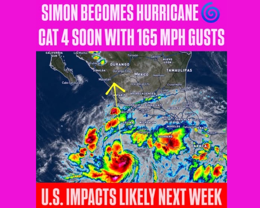
Hurricane Simon has strengthened into a Category 1 storm in the Eastern Pacific, with maximum sustained winds of 75 mph (120 kph), and is forecast to intensify rapidly into a potentially devastating Category 4 hurricane before approaching Mexico’s Pacific coast on Saturday.
Meteorologist Chris Nunley warned that the storm could strengthen dramatically over the next 24 to 36 hours as its structure becomes better organized. The National Hurricane Center’s forecast also calls for rapid intensification, with winds potentially reaching 140 mph (225 kph) before Simon approaches the west-central Mexican coastline.
“A potentially devastating landfall is becoming increasingly likely Saturday evening!” Nunley said in an update shared on Facebook.
Simon was located approximately 235 miles (378 km) south of Manzanillo, Mexico, in the latest information provided by Nunley. It was moving west-northwest at about 6 mph (10 kph), with forecasters expecting it to turn northwest before tracking north toward the coast.
The approaching storm threatens coastal communities with destructive winds, dangerous storm surge and large waves. A hurricane warning has been issued for part of Mexico’s Pacific coast, and authorities are preparing for potentially life-threatening conditions.
Simon Threatens Torrential Rain, Flash Flooding
Heavy rainfall poses another major danger as Simon approaches land. Forecasts call for 8 to 15 inches (20 to 38 cm) of rain across parts of southwestern Mexico, with isolated totals of 15 to 25 inches (38 to 64 cm) possible in Michoacán, Colima and Jalisco.
The rainfall could trigger severe flash flooding and mudslides, particularly in mountainous areas where water can accumulate rapidly and destabilise slopes. Dangerous surf and rip currents are also expected along parts of the coast as swells generated by the hurricane spread across the region.
The combination of rapid intensification, heavy rain and a possible major-hurricane landfall leaves a narrow window for communities to complete preparations. Residents in areas under warnings should follow local evacuation orders and emergency guidance.
Hurricane Simon’s Remnants Could Bring Rain to US
Simon is forecast to weaken rapidly after moving inland across Mexico, but its remaining moisture could influence weather conditions across parts of the United States next week.
Nunley cautioned that the storm’s remnants could interact with approaching upper-level weather disturbances, potentially bringing additional rainfall to Arizona, New Mexico, Colorado, Oklahoma and Texas. The extent of that rainfall remains uncertain because it will depend on how much tropical moisture survives the storm’s passage across Mexico and how the wider weather pattern develops.
“Although Simon is forecast to weaken rapidly after moving inland across Mexico, its remaining tropical moisture could eventually become involved in the larger weather pattern across the Southwest United States next week,” Nunley said.
Recent heavy rainfall across parts of the Southwest and Southern Plains adds to the importance of monitoring the evolving forecast. However, direct hurricane impacts are not currently expected in the United States, and any rainfall there will depend on Simon’s eventual track and interaction with other weather systems.
For now, Mexico’s Pacific coast remains the area facing the most immediate danger. The National Hurricane Center expects Simon to approach the west-central coast as a major hurricane on Saturday, with life-threatening wind, storm surge and flooding possible.
 Arun Kumar N